More than 40 million people are on alert as the next winter storm is forecast to bring snow, strong winds and rain from the Dakotas through the Great Lakes and into northern New England in the coming days.
As of Sunday morning, blizzard warnings were in effect from Grand Forks and Fargo in North Dakota to Rochester, Minnesota, and Mason City, Iowa, for snowfall of 3 to 8 inches and winds gusting up to 45 mph, creating blackout conditions and near-zero visibility into Monday morning.
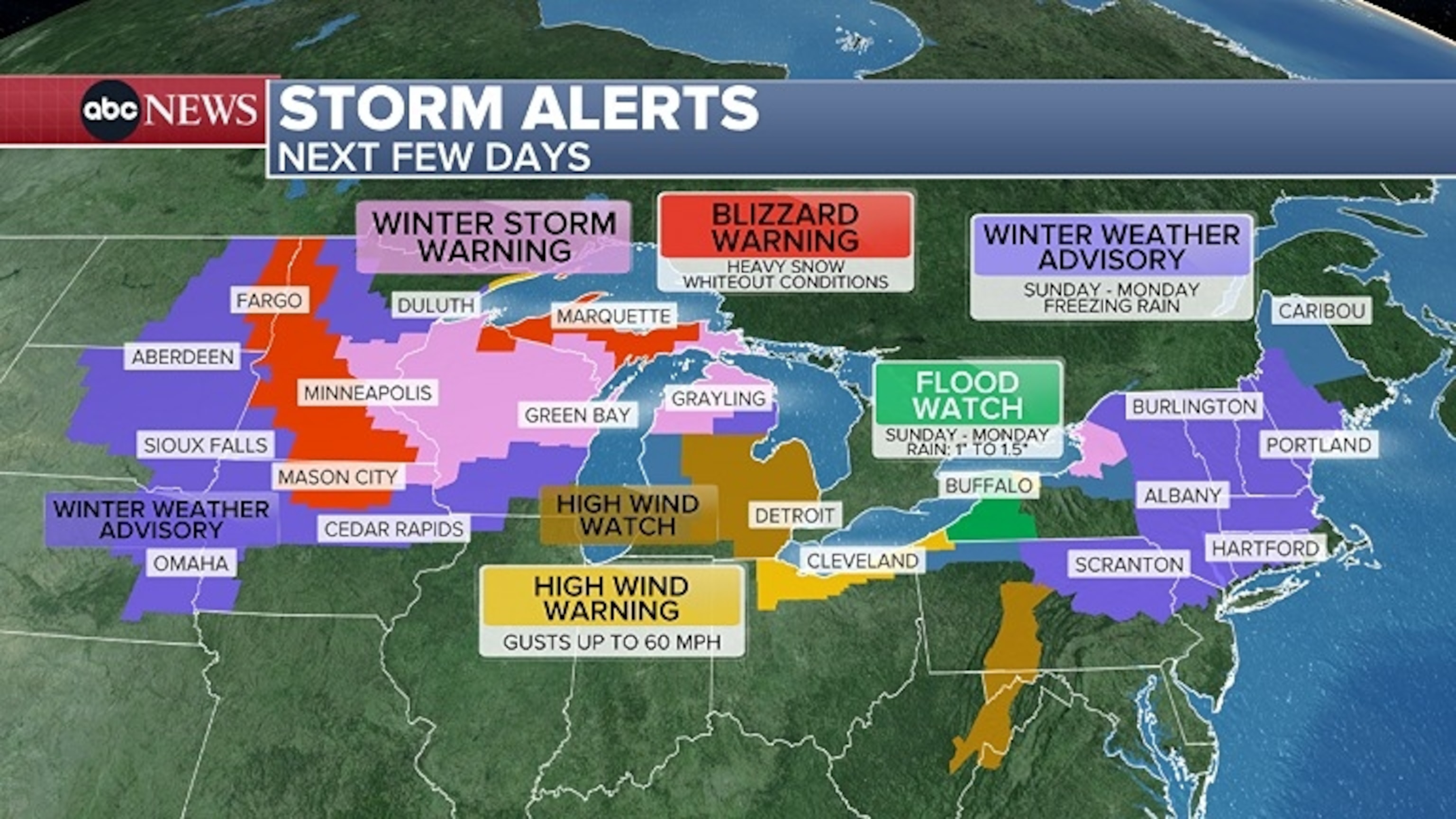
This graphic from ABC News shows the expected winter storm.
ABC News
Blizzard warnings are also in effect for Michigan’s Upper Peninsula, where snowfall between 9 inches and 2 feet is expected, along with wind gusts of up to 60 mph.
From eastern Minnesota to northern Michigan, including Minneapolis, Green Bay and Sault Ste. Marie: Winter storm warnings are in effect due to heavy snow and gusty winds expected Sunday through Monday.
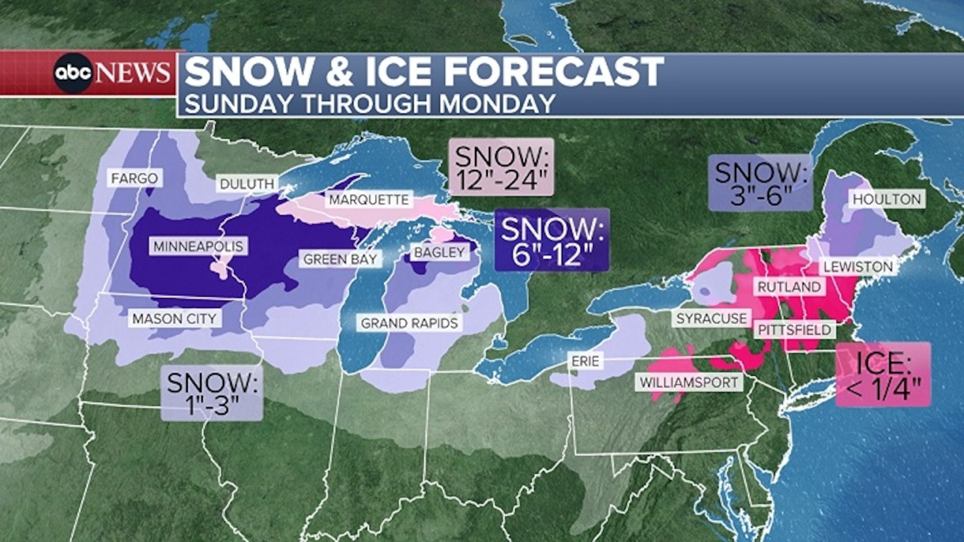
This graphic from ABC News shows the expected winter storm.
ABC News
In the Northeast, winter weather advisories are in effect from Scranton, Pennsylvania, to Burlington, Vermont, and Portland, Maine, for freezing rain Sunday through Monday.
A flood watch was also issued for Buffalo and Jamestown, New York, for up to 1.5 inches of rain Sunday afternoon through Monday afternoon.
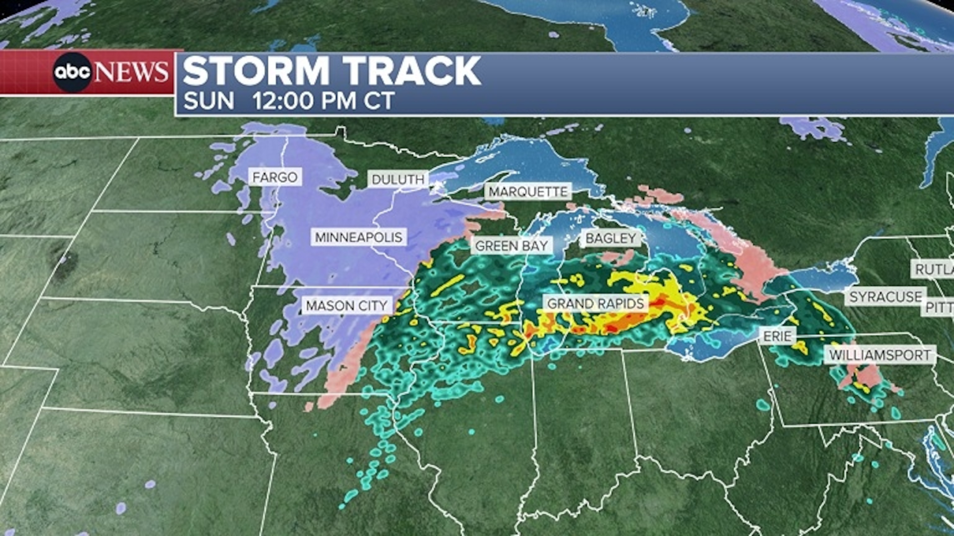
This graphic from ABC News shows the expected winter storm.
ABC News
High wind watches are also in effect for Detroit and Cleveland for gusts up to 60 mph Sunday night and into the early hours of Tuesday morning.
The latest winter storm is expected to move into the Midwest on Sunday afternoon. Snow had already begun to fall in Sioux Falls and Fargo early Sunday.
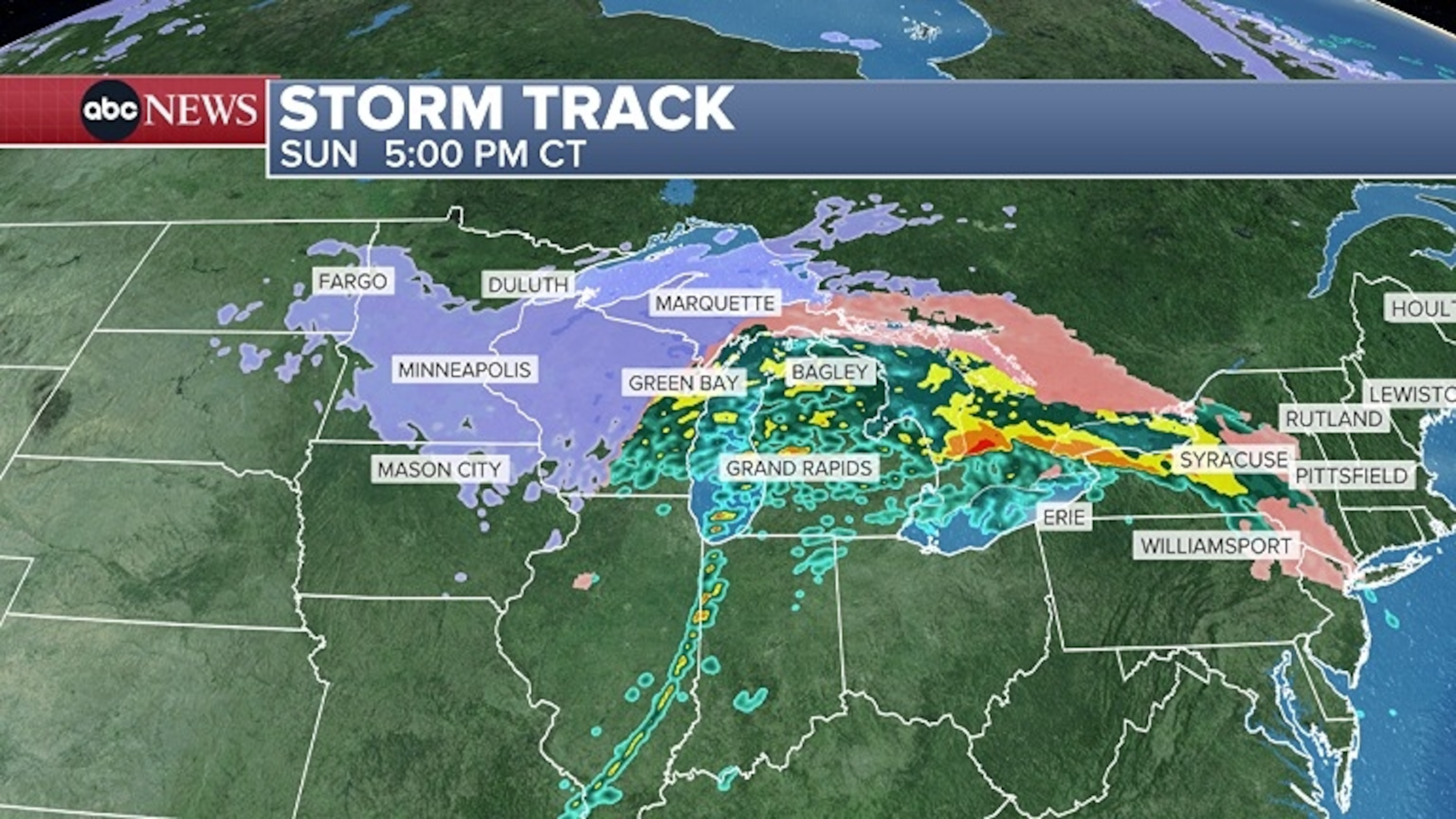
This graphic from ABC News shows the expected winter storm.
ABC News
Heavy snow is forecast to reach Minneapolis and Mason City, Iowa, around 12 pm CT on Sunday. Marquette, Michigan, and Green Bay, Wisconsin, are expected to see a wintry mix Sunday afternoon, with heavy rain lingering across southern Michigan, including Grand Rapids and Detroit.
By early Sunday afternoon, Minneapolis and Marquette are expected to see heavy snow and gusty winds. Visibility will be reduced in these areas, as well as portions of I-45 and I-90. Heavy rain and gusty winds are forecast to reach Buffalo, New York, on Sunday night.
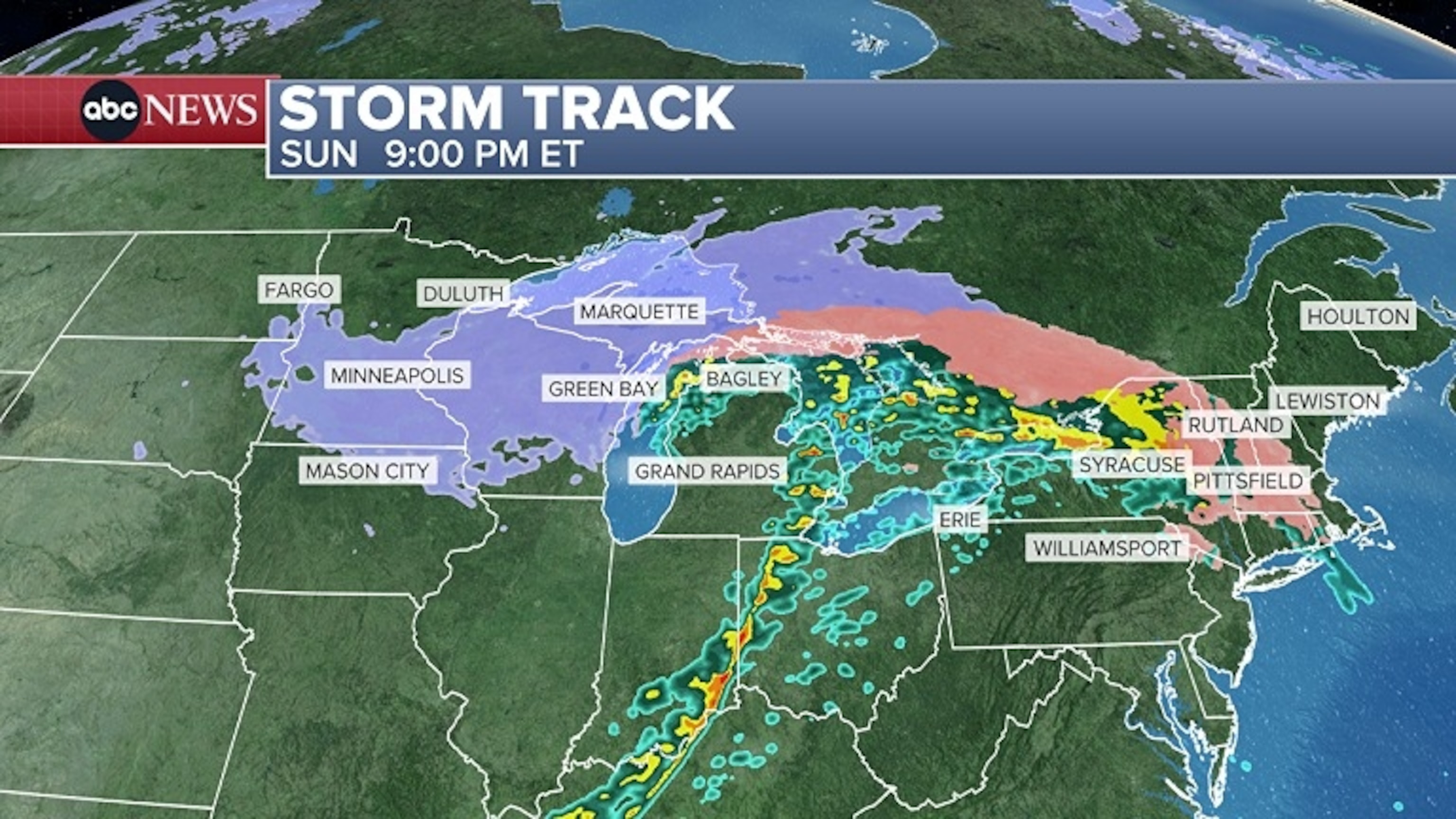
This graphic from ABC News shows the expected winter storm.
ABC News
Parts of the I-95 corridor from Philadelphia to Boston could experience a brief wintry mix or freezing rain Sunday night around 5 p.m., which is expected to turn to rain as warmer air moves in.
Snow and gusty winds are expected to continue in Michigan until around 7 a.m. ET on Monday, after which warmer air moving north through the Northeast is forecast to produce rain.
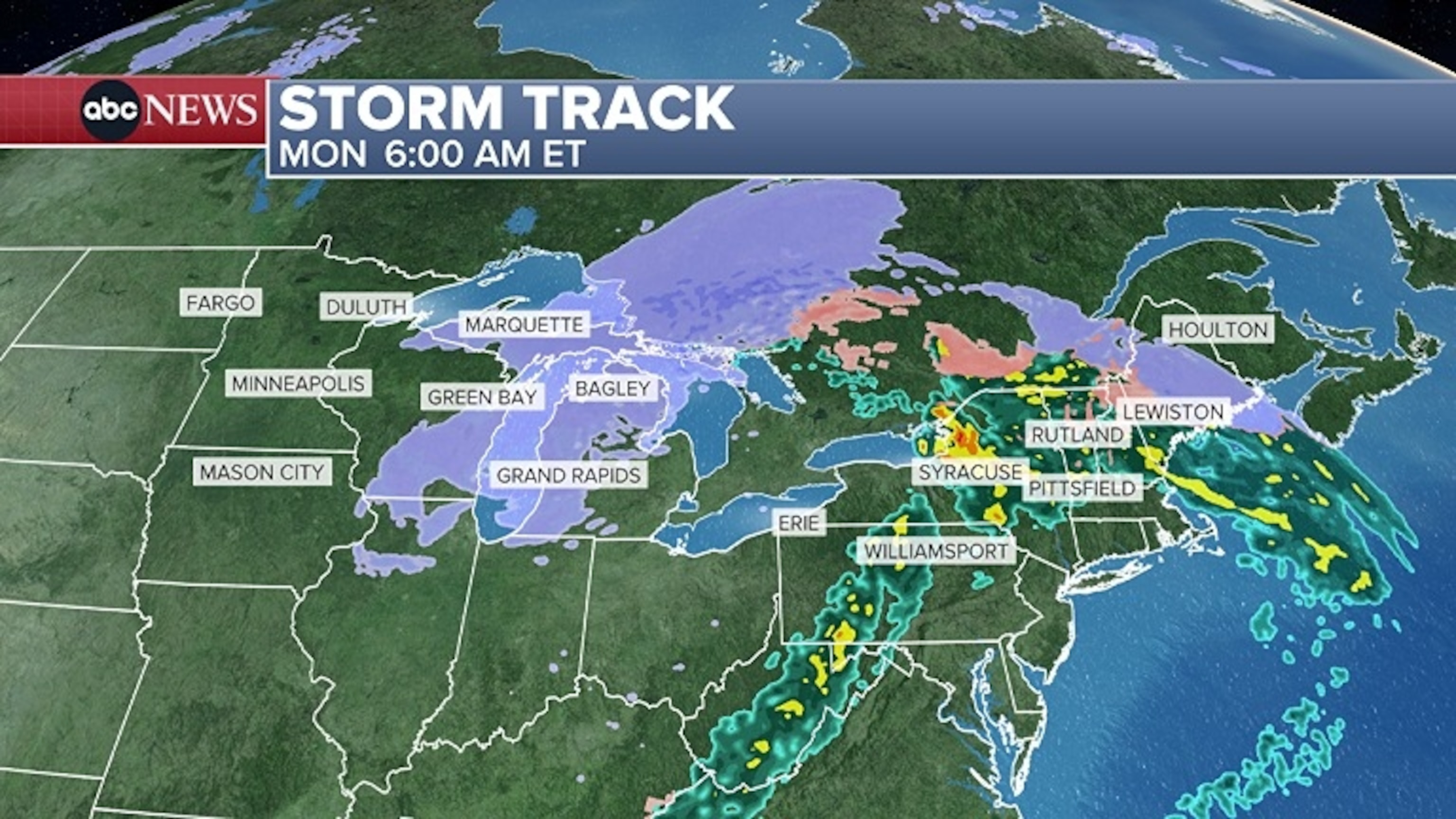
This graphic from ABC News shows the expected winter storm.
ABC News
Most winter precipitation in the Northeast is expected to be limited to the higher elevations of northern New England and most of Maine. Freezing rain is forecast for northern New England, especially at higher elevations.
The storm system is expected to have largely dissipated by Monday night, although lake effect snow is forecast to follow. It is expected to be normal lake effect snow for the eastern Great Lakes and interior Northeast, continuing through Tuesday and possibly Wednesday.
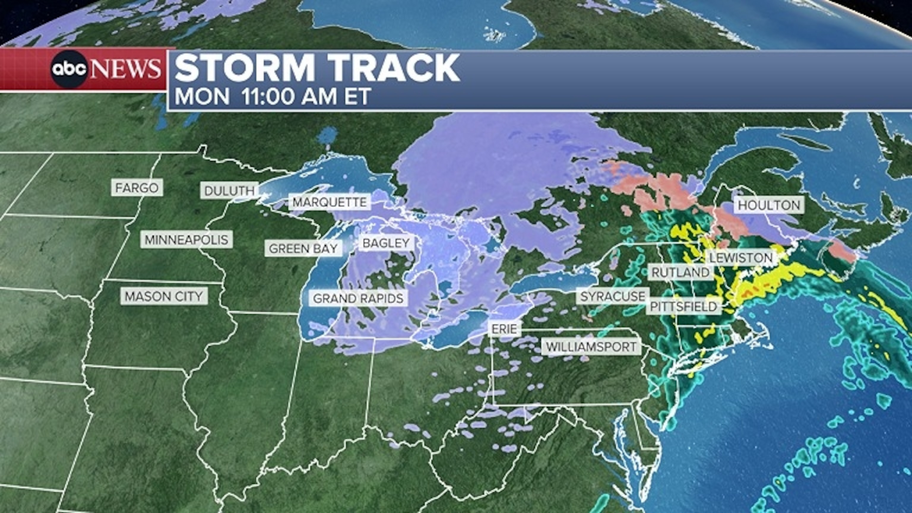
This graphic from ABC News shows the expected winter storm.
ABC News
The heaviest snowfall is forecast in the Midwest. Minneapolis and Green Bay could see 5 to 8 inches of snow and a light coating of ice.
Marquette and most of Michigan’s Upper Peninsula could see 1 to 2 feet of snow. Wind gusts there could reach up to 60 mph during and just after the event, which could create blowing snow after the snow has ended.
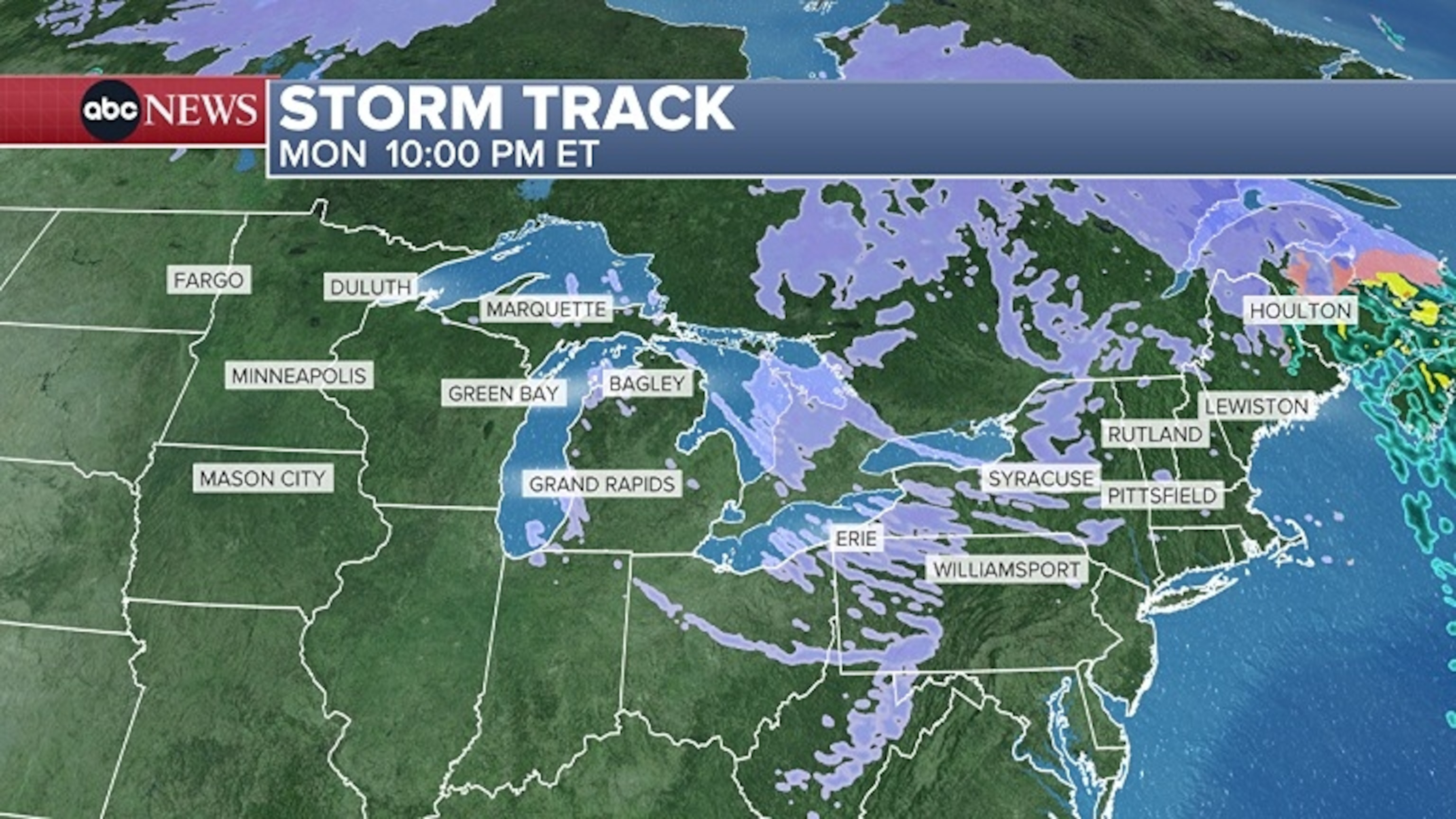
This graphic from ABC News shows the expected winter storm.
ABC News
The interior Northeast along the Great Lakes and into northern New England is expected to see lighter snow and a wintry mix with this event. Parts of northern New England could see up to a quarter of an inch of ice on Monday.


