More severe weather conditions are forecast on both coasts when the ball drops Wednesday night, heralding the year 2026.
On the West Coast, more rain will arrive on Wednesday in soggy Southern California, where residents are still recovering from last week’s flooding.
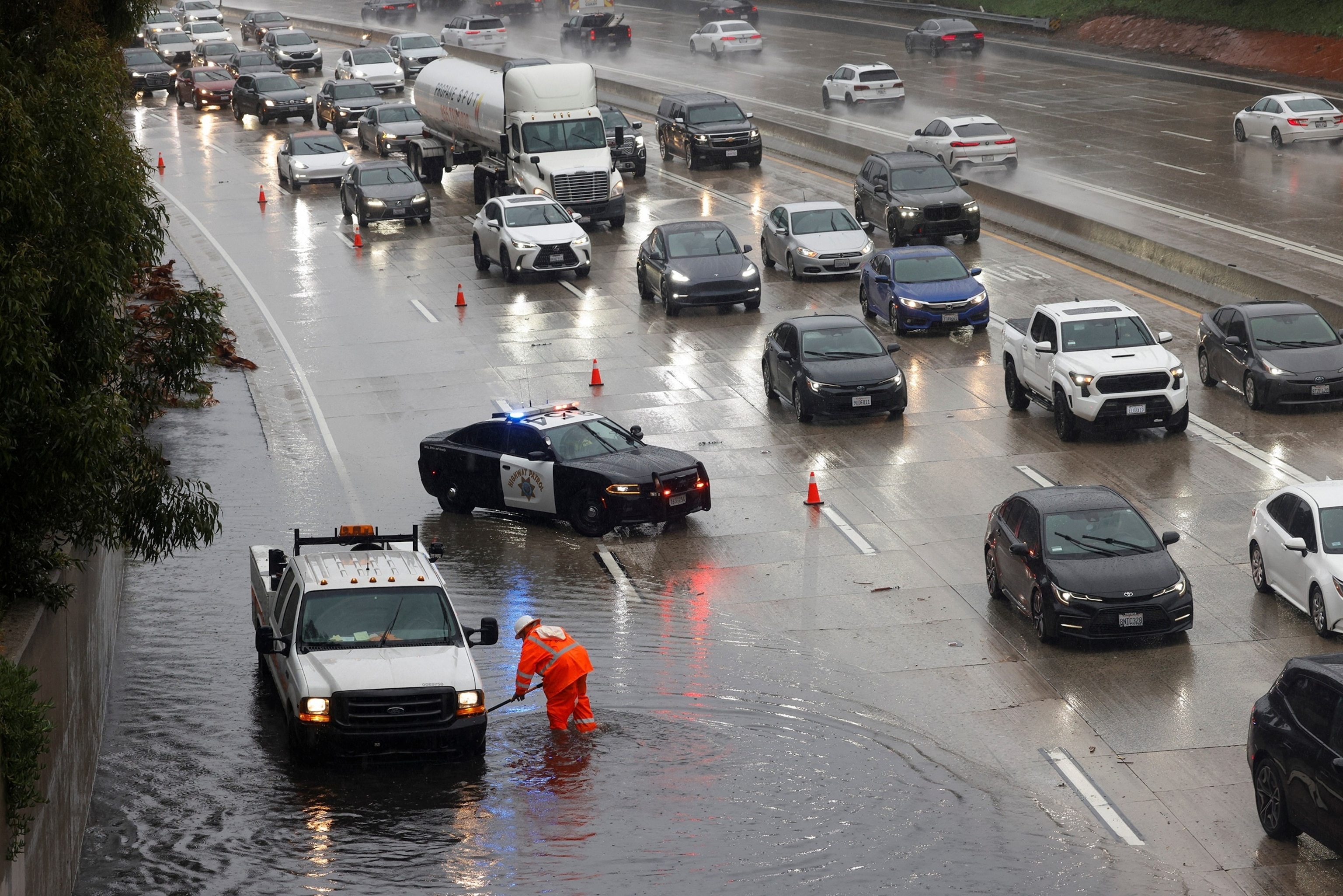
A worker clears debris from a flooded portion of Highway 134 as heavy rain falls due to an atmospheric river in Burbank, California, on December 24, 2025.
Jill Connelly/Reuters
In the Los Angeles and Santa Barbara areas there is a risk level of excessive rain of 2 out of 4 on New Year’s Eve and Day. One to 2 inches of rain is generally expected in the Los Angeles area, but higher elevations could see 2 to 4 inches of rain.
More than 17 million people in Southern California are under a flood watch, and debris flows and landslides are also possible.
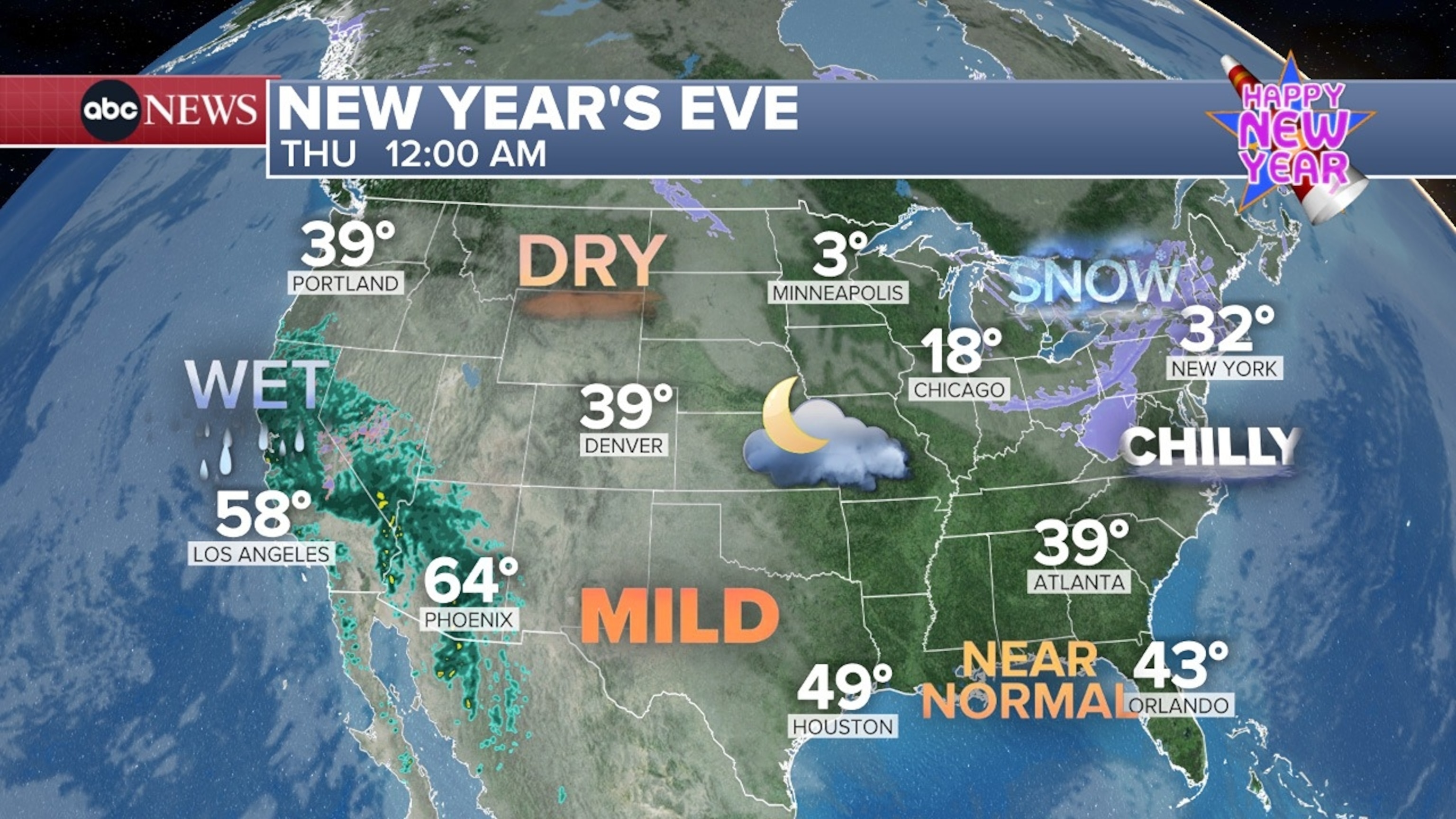
New Year’s Eve – Thursday, 00:00 Map
ABC News
At noon Wednesday, rain will fall from Los Angeles to the Bay Area. It will spread further across the state in the afternoon, with even passing showers expected in Las Vegas and Arizona into the evening.
Much of the Southwest, from California to Nevada, Arizona to Utah, will rain as the clock strikes midnight, and heavy rain will continue in Los Angeles through the morning.
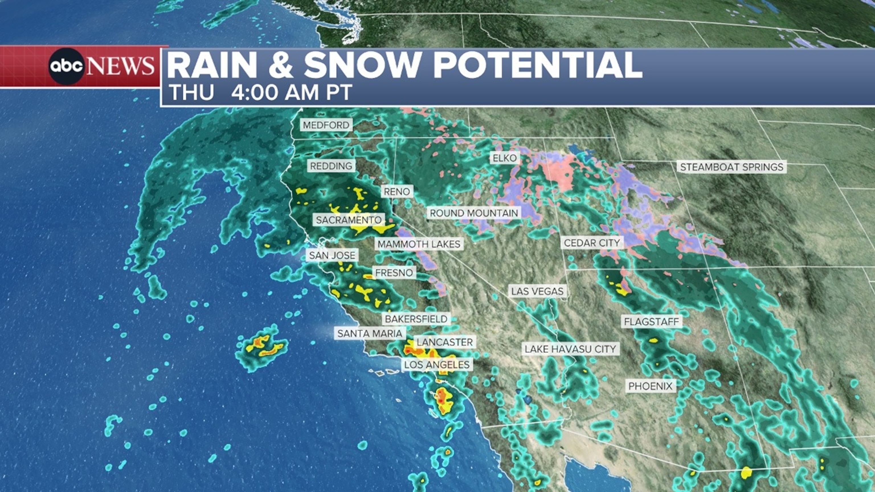
Rain and Snow Potential: Thursday at 4 a.m. PST Map
ABC News
On Thursday, rain will spread northward into Washington and Idaho.
Meanwhile, a fast clipper system is bringing more snow to the upper Midwest and Northeast on New Year’s Eve.
The heaviest snow will be lake effect snow on the Great Lakes.
In Pittsburgh, Pennsylvania, a winter weather advisory is in effect for 3 to 5 inches of snow from Wednesday afternoon through Thursday morning. Strong winds can reduce visibility at times.
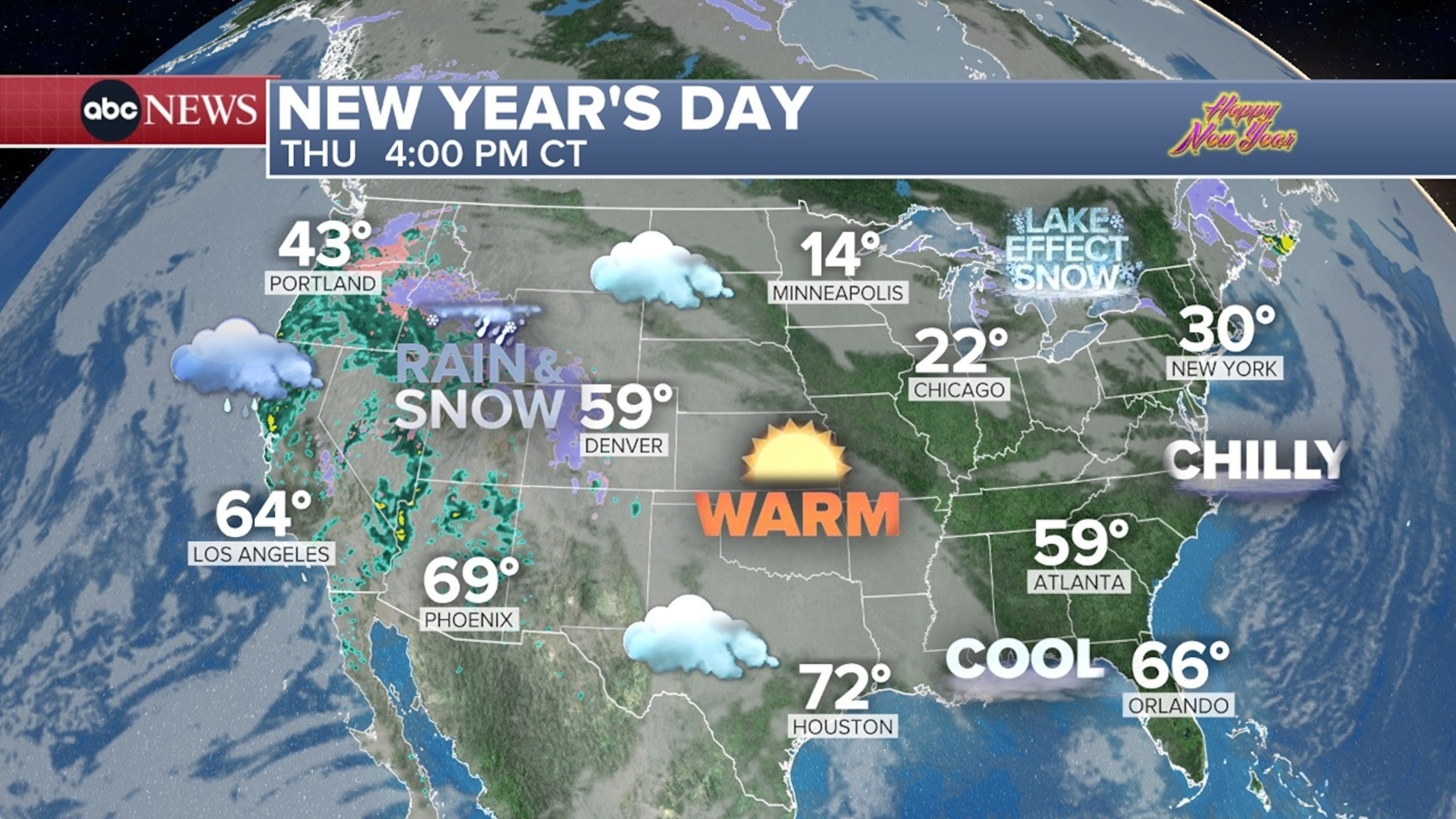
New Year’s Day: Thursday, 4 pm CT Map
ABC News
Syracuse, New York, which saw a whopping 2 feet of snow on Tuesday, marking the city’s snowiest day in nearly 80 years, could receive an additional 4 to 8 inches on Wednesday.
Around Orchard Park, New York, home of the Buffalo Bills, 1 to 2 feet is possible on Wednesdays and Thursdays.
When the ball drops in Times Square, New York We could see some flurries, but little to no snow accumulation is expected. The wind chill (the temperature you feel) will be in the 20s when the ball drops.
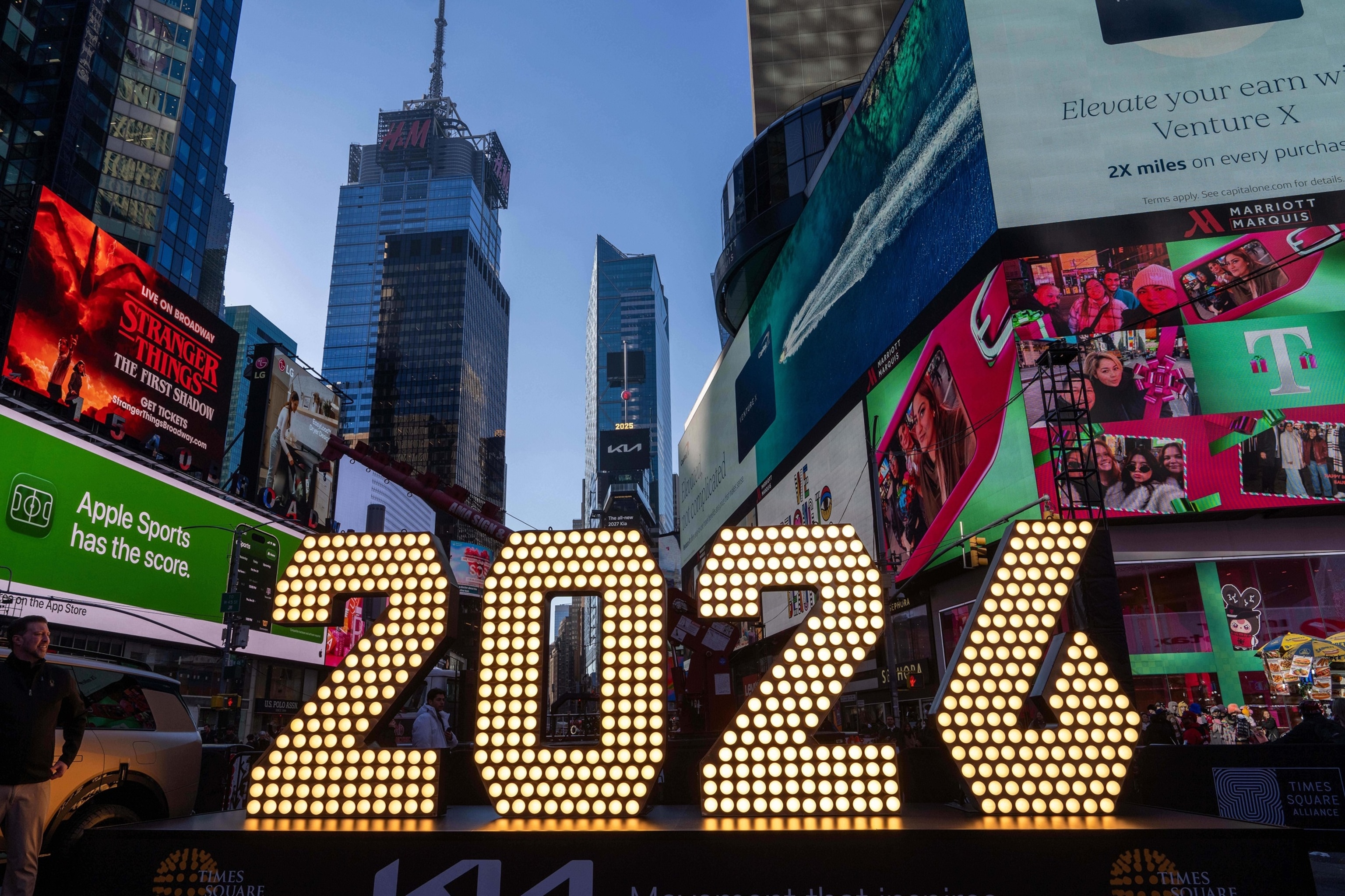
The 7-foot-tall numbers “2026” are displayed at a lighting ceremony in Times Square on Dec. 18, 2025, in New York.
Adam Gray/AP
Boston could receive 1 to 3 inches of snow between ball drop and 7 a.m. Thursday.
Lake effect snow will continue throughout the week, with some parts of upstate New York seeing 1 to 3 feet of snow Saturday morning.


